

It would appear to be quite clear. An Interchange is a good place to change from one "Tube" line (now, according to the "Tube" map, from one TfL service) to another.
We can assume, although it is not stated anywhere, that changing from TfL Rail to National Rail is not defined as an "Interchange". Thanks to the non-integrated fares system, regulars will know that this involves leaving TfL territory by passing OUT through a "gateline" of ticket barriers then back IN via the "gateline" of the other system.

Here is the exit from Vauxhall South Western Railway station ...

... opposite which are steps to the separate Underground station ...

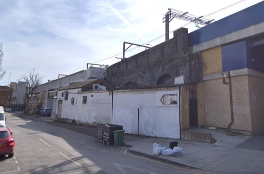
Elephant and Castle is worse.

Historically the two stations were not considered interchange-worthy and are situated today at opposite ends of a shopping centre.
But we should not expect interchange to be barrier and walk free between the two systems, should we?
Why not?
But that's the way it is and we must cope with it, apparently.
We are all (mostly) familiar with treks through the tunnels when crossing from one Underground line to another. At Euston, for example ...

... a fairly simple set of tunnels and escalators links the three lines together. Underground signposting is always good.
But why is Euston Square not part of the "interchange"?

It never has been as it involves a short walk past the historic porticos ...

... and along Euston Road.

With HS2 we are promised a proper link.
The existing route is not much different from some of the walks between Underground entrances at nearby Kings Cross!
The existing route is not much different from some of the walks between Underground entrances at nearby Kings Cross!

Perhaps Euston Square should be shown as a "walking" interchange.

Tower Hill to Tower Gateway is a similar distance. You leave Tower Hill Station, walk along London Wall (footway behind tress left in the picture below) ...

... cross the busy Minories and enter the dome ...

... of the original historic terminus of the Docklands Light Railway - now much "heavier" than its original conception. No different in esseence from Euston to Euston Square.
West Hamsptead has three totally separated stations ...

From south to north, these are Underground Bakerloo Line, West Hamsptead Overground (formerly named West End Lane) and West Hampstead Thameslink (formerly Midland).

There is no affinity in names at Wanstead Park and Forest Gate. Between the two ...

... is a ⅓ mile walk along Woodgrange Road.

If Euston Square is no part of an interchange, then this isn't either. It really SHOULD be shown as an interchange "via streets". Maybe a dotted line with a walking man symbol instead of and interchange "dumbbell"
Hackney used to be a "pig".
 It involves leaving "Downs" and walking via Dalston Lane and Amhurst Road ...
 ... before creeping up a little back-alley entrance to Central.
 Once upon a time, however there was a high level walkway between the two ...
 ... seen here bridging the tracks through Central. It was later demolished! This has now been replaced on a similar alignment by a brand new walkway.
 But it now has lifts as well.
 This has become an EXCELLENT and obvious interchange.
Can a troubled traveller Interchange at Heathrow?
 Apparently not with Crossrail/TfL Rail/The Elizabeth Line where stations are shown as bewilderingly separate from the Piccadilly.
How would our readers attempt to travel between Hounslow and Ealing? And what fare might they have to pay?
 Really?
There is no doubt that a rethink in the quality of an "interchange" is long overdue.
Again something that might be predicated by a better "London Connections" type map showing TfL Rail AND the more frequent suburban services of the National Rail companies.
Will it ever happen?
Jezza wants to re-nationalise the "big" railways; but Tony promised the same many, many years ago and it did not happen. Yet, even with some form of re-nationalisation there would still remain a separate Transport for London.
It will be a courageous politician that sorts it all out!
A Matlock P.S.
As of 2200 last evening Stagecoach on-line was showing its own correct timetable ...
 ... having appeared on Tuesday last. The PTE on-line timetable appeared yesterday.
 Roy managed to pick up an updated printed leaflet on Wednesday evening from an X17 bus.
 Traveline, however, was still useless.

 Getting better.
Hackney used to be a "pig".


Can a troubled traveller Interchange at Heathrow?

How would our readers attempt to travel between Hounslow and Ealing? And what fare might they have to pay?

There is no doubt that a rethink in the quality of an "interchange" is long overdue.
Again something that might be predicated by a better "London Connections" type map showing TfL Rail AND the more frequent suburban services of the National Rail companies.
Will it ever happen?
Jezza wants to re-nationalise the "big" railways; but Tony promised the same many, many years ago and it did not happen. Yet, even with some form of re-nationalisation there would still remain a separate Transport for London.
It will be a courageous politician that sorts it all out!
A Matlock P.S.
As of 2200 last evening Stagecoach on-line was showing its own correct timetable ...


Next weekend collection blog : Saturday 10th November
You're a few decades out of date, FBB. West Hampstead tube is on the Jubilee line these days.
ReplyDeleteNot of the highest quality, but this Metropolitan Line car diagram http://www.londonbusblinds.com/prodimages/UNFRAMED01%20Metropolitan%20Line.jpg
ReplyDeleteshows that Euston Square is shown as an interchange for Euston overground, with a note how far it is in metres in a box. Other stations are similarly treated on in-car diagrams.
I am sorry, but your basic assumption is wrong, both historically and particularly today.
ReplyDeleteInterchange is simple about changing or exchanging. The old cardboard “Underground Diagram of Lines” (I am looking at a 1965 version) did not show any external interchanges. In this diagram interchanges between the routes shown on the map are given as black circles and the NR, boat, plane, etc symbols show the interchanges to other routes not on this diagram. The interchanges have been added to today’s diagram to illustrate the integrated transport system. The National Rail diagram shows the combined rail network, but it is a much bigger map to show all the detail.
Historically there were always some NR and tube through fares such as to cope with the Bakerloo and Metropolitan having common platforms with NR. There were others.
Today London has a fully integrated ticketing system which includes buses, trams, tube, National rail, DLR, cable car and river buses. It is called Oyster, but you can use Contactless in the same system or Travelcards. It even goes outside the London Boroughs in part. Single tickets are also available. The whole philosophy of fares in urban areas has changed. It is no longer about single tickets, but about day / week / month tickets over defined areas of network using defined modes giving unlimited travel. Most people travelling want a return anyway. With today’s geography in big towns and cities there is often not a direct service and the day ticket allows you to take as many trips as you need to complete your journey without a fare penalty. Today in London you can use any mode you like, go any route you like and within certain rules it will cost the same. It’s great and it works.
Just a quick question. Didn't even the 1965 map show some interchanges with BR as square or diamond shapes, or with little dots inside the round bits?
ReplyDeleteYes I missed the dots. In 1965 some stations have dots within black circles to indicate British Railways interchanges. Gunnersbury no longer has BR. The 1965 map predates the Victoria line and I had it out to show Onger on the Central line.
DeleteAlso aren't the linked stations such as West Hampstead known as OSI - out of station interchange, where an Oyster tap out followed by a tap in at a sister station within a certain time cancel each other out and the two leg journey is charged as a single journey.
ReplyDelete