
TWO Network Maps

The general concept of the Munich "Regional" map is that a passengers would transfer from bus to U -Bahn, S -Bahn or R egional railways to continue a journey into central Munich. Unlike London, where bus fares are cheap and rail fares of all types are expensive, the zonal fares structure is consistent across the whole network. Those seeking a journey from "out of town" to central destinations are not discouraged by price from transferring to the various "steel rail" networks.
Trams are not shown at all, presumably because only the suburban rail networks appear inside the city "box".
The same treatment is reserved for many of the suburban hubs ...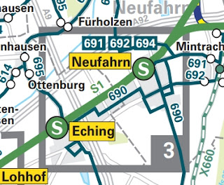 ... but here, helpful enlargements are shown at the edges of the main map.
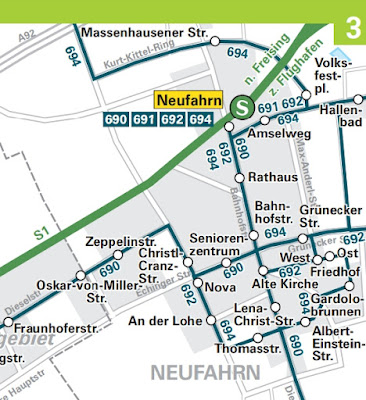 Note that, on the main map, all stops are shown plus selected names for unserved roads. The bus route numbers are designed to be in some sort of numerical order in each area wherever possible, hence 690, 691, 692 and 694 at Neufarn.
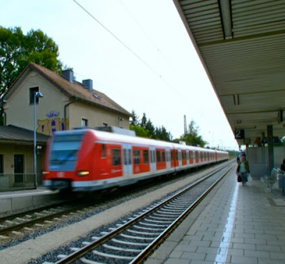


For each rail stop MVV provides a station plan ...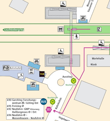 ... a list of what stops there ...
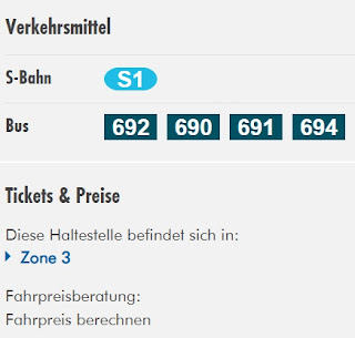 ... a detailed local street map ...
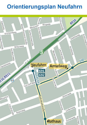 ... plus, obviously, timetables for bus and train all in the one place!
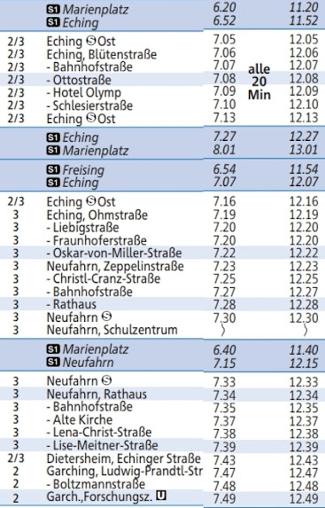 Note that the bus timetable (e.g. 690, above) includes summarised details of connecting rail services; and experience shows that they will connect!
 And you may have spotted that, at its "city" end the 690 terminates at a very swish Underground stop, Garching Forschungszentrum ...
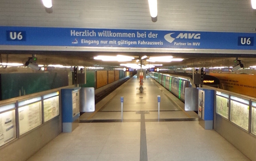
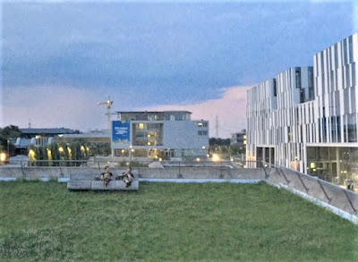 ... the northern terminus of Line U6.
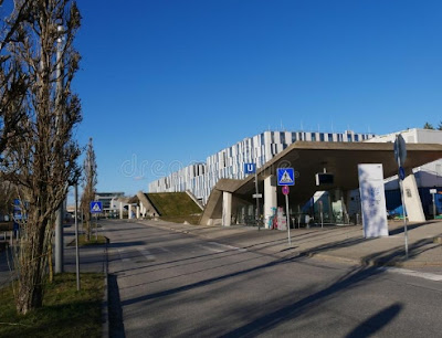
 And it has a Park & Ride site with VERY reasonable charges.


The Campus Garching (German: Hochschul- und Forschungszentrum Garching) is a campus of the Technical University of Munich and a number of other research institutes, located around 10 km north of Munich in Garching. At the same time, it constitutes a district of the city. With more than 7,500 employees and around 17,000 students, it is one of the largest centres for science, research and teaching in Germany.
Which brings us nicely across "the border" and on to the Munch "central" network map.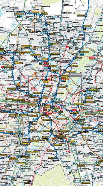 Wowsers!

fbb guesses that this piece of cartographic magnificence is only available on-line. At 100% enlargement on-screen it is still frighteningly "concentrated". But we can zoom in and make a start at Garching Forschungszentrum.
Only we can't! Garching Forschungszentrum is not on the city map ...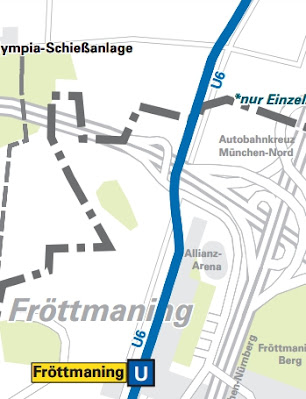 ... despite being "over the border" on the regional map.
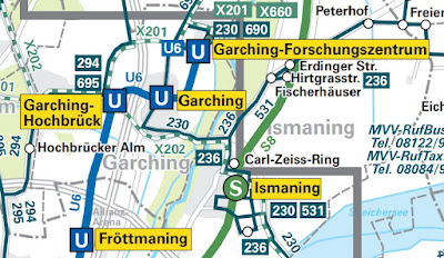 Hmmm? Maybe the city map needs an "extra bix" added?


Don't be foolish fbb; this is Germany ...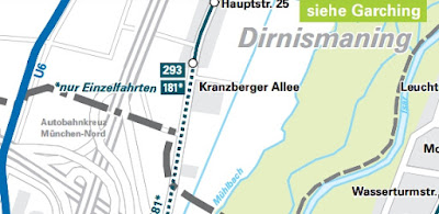 ... and (see above, upper right) there is a Garching enlargement! For visibility in the blog, fbb has cut off Hochbruck (centre left) on the enlargement.
 The main enlarged section for this map is of the centre of Munich; again too big to include in full. But here is Ostbahnhof (of bus 55 fame!) ...
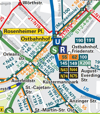 ... and we have some bus routes (including the 55) in ORANGE instead of blue and something in RED; fbb will save you the mental anguish as these are Munch's city trams. Here, again, is a tram 21 at Ostbahnhof.
 But?
But?


Is this map too complex with too much detail for general use?
Would a series of sector maps be easier to use?
The Public Transport mantra may well apply. You can be comprehensible or comprehensive but never both.
It is worth noting, however, that most buses stop short of the complex Hauptbahnhof area, leaving it to train and tram.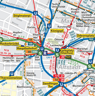 It's tramway fun all the way in the very centre of the city!
 The four-way junction north of the station looks a bit scary without trams and must be terrifying with trams, traffic and pedestrians!
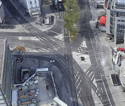 This blog will conclude tomorrow.


Next Variety blog : Saturday 23rd July
It is one of those big differences between mainland Europe and ourselves. They seem fine with having to change modes where as we want a direct service or we'll just use the car.
ReplyDeleteMight that be because their is integrated information, sensible connections between modes, and common ticketing? I think people in London are quite happy to change between bus and tube, knowing that it can all go on their Oyster or contactless card.
ReplyDeleteWhoops - "there is", of course!
ReplyDeleteThe printed map (size A2) can be ordered online https://www.mvv-muenchen.de/mvv-und-service/service-shop/infomaterialbestellung/index.html so hotels can put it up for their guests... (an lots of other printed information as well...)
ReplyDelete