
Three Pits

fbb is grateful to correspondent and chum Peter for helping identify the sites of the collieries in the Seaham empire of The Earl of Londonderry.
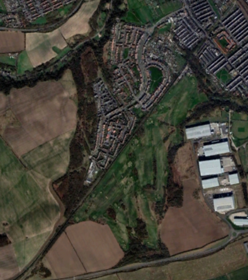
To the south of town was Dawdon pit. It is now a warehouse industrial estate.
 To the north of town was Vane Tempest pit ...
 ... which has been replaced in its totality by a housing estate called East Lea (East Shore?).
 The little wiggle in the brown road on the map (upper right) can be spotted on the aerial view of the colliery (picture above, upper left).


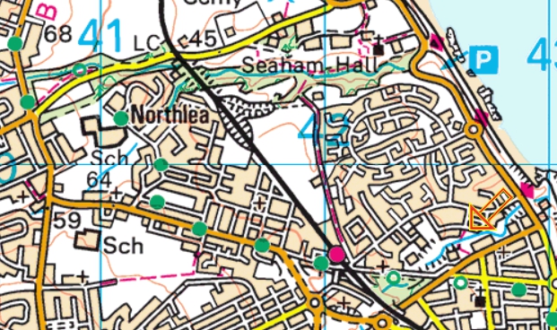
Also on the above map, bottom left is "Sch".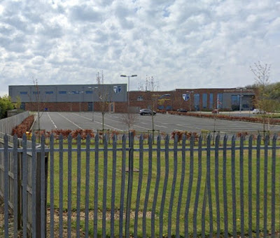 Seaham High School has been built where Seaham Colliery once stood.
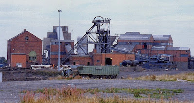 Apart from memories there is little left to show that coal was even mined in the Seaham area ...


... noting the "L" for Londonderry. Other colliery lettering is available. The wagons were always black. Even if they weren't black when built, they soon attained the colour of their contents.
Getting coal to boat was tricky and structures changed over the years. Originally there was a rope hauled slope to get wagons to and from the "sea" level.
There were sidings on the upper lever, now a Shopping Centre. It is well-nigh impossible, even with a significant stretch of the imagination, to imagine the shops ...
 ... replaced by lines of wagons of various sizes.
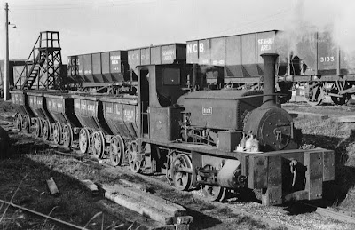 What we can imagine is the route of the line from Sunderland big train station as far as the top of the hill at the Harbour.


The former track is now a footpath seen below on the right in an avenue of trees. There is even a little bridge where the wagons could pass under a local road.
 But, once we reach the previously spotted roundabout ...
 ... all signs of the link are lost.
 The line from Dawdon pit has been subsumed under an improved road, but the route coming in from further afield ( lower left) ...
 ... forms a foliage scar with a footpath running from bottom left to top right in the aerial view above.


If you know where to look, you can ferret out a little of Seaham's coal mining heritage.
So far so good - but what of the docks themselves. Is anything left.
Tomorrow's blog will investigate.
Anyone for coffee?

THE ANSWERS TO THE QUIZ WILL APPEEAR IN SATURDAY'S AND SUNDAY'S BLOGS.
Next Seaham blog : Friday 2nd September
No comments:
Post a Comment