
Mission Impossible?

Good Morning Mr Felps B B, In this envelope are details of the network of bus services run by Eastern Counties in Norwich in 1970. Your mission, should you choose to accept it, is to create a simple route diagram for inclusion in a top secret project headed by Mr K, a good friend of our Government. We expect our enemies to use every possible trick to impede this vital work.
Should you fail, or be caught or killed, the Secretary will disavow any knowledge of you, your team or this vital project.
This tape will self destruct in five seconds.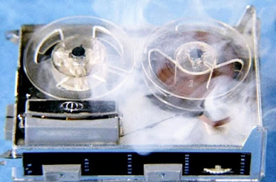 How could fbb refuse?Appropriate eh? The TV show as captioned was broadcast in 1969, one year before the "secret diagram" was to be dated.

Cringleford?
fbb hardly dares to admit that he has never been to Cringleford. But the name joins a long list of arcane place names in the UK that includes Pratts Bottom, Plucks Gutter and the utterly delicious Nempnet Thrubwell!
Cringleford, and neighbouring Eaton, sat astride what became the A11 from Norwich to Wymondham and on to London.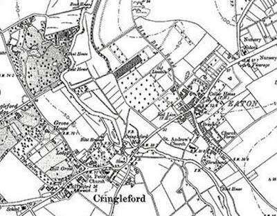 By 1970, of course, Norwich had expanded to envelop these former villages, although a taste of Cringleford of old is still extant if you look closely.
 Mt K's information looked fine and fbb was able to create a reasonable geographical representation of the routes to Cringleford in 1970.


Being 1970 and being typical of the former Tilling Group of companies, Eastern Counties would strive to serve every area of "greater" Cringleford and Eaton.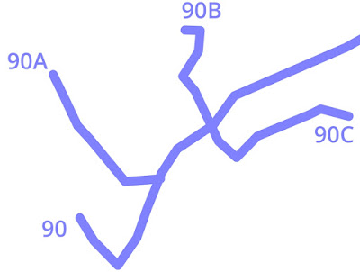 With a fairly straightforward stem and branches, it seemed relatively easy to create a simpler diagram. The initial idea was to stick to 90 and 45 degree corners.
 But there is a danger that, in following such a rigid plan, fbb might mangle truth to such an extent that the result would be useless as a "historic" representation of the 1970 network.


So task number one was to go to Google Maps and see if there was any evidence of today's buses travelling roughly where either of the two fbb-created maps suggested.
Mr K had provided destination names for each route.
90 - SCHOOL
There, at the junction of Cantley Lane and Keswick Road is what might well have been a school and schoolhouse but is now a private dwelling. Here are the kiddies on an undated picture, off to an Ascension Day service at the Church ...
 ... and there is the head teacher's posh house today, attached to the schoolrooms.
 There are bus stops today, in both directions, near the school.


90A - COLNEY LANE
The road still exists ...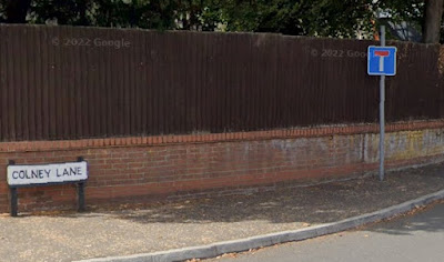 ... with a junction with Newmarket Road, once the A11. Colney Lane crosses the new fast A11 on bridge ...
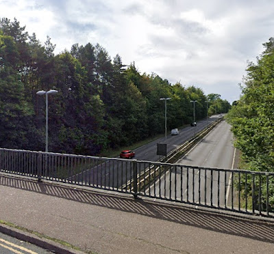 ... and Mr K shows a terminus a little further along the lane at St Lawrence Drive.
 Almost all the property along here is "posh" and, even in 1970, unlikely to be "good bus territory". Was there perhaps something more mundane down the lane that warranted a bus service? There is no sign of one now! There are no stops shown on Google Maps.


There is, however, a stop back at the junction with Newmarket Road ...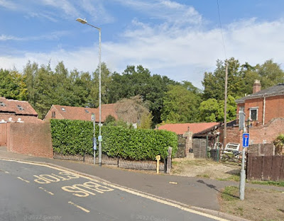 Although it looks a bit odd, it isn't. Buses leave the new fast A11 on a slip road ...
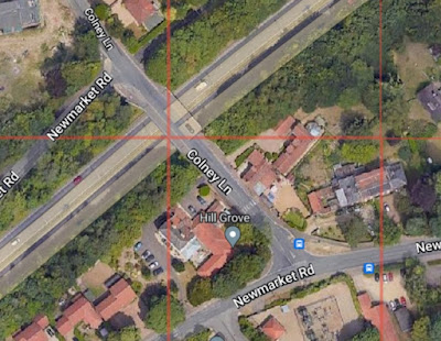


... then turn right over the super road, stopping as above before hanging a left on to the remnant of the original Newmarket Road.
90B - BLUEBELL ESTATE
Sweet! You get to it along Bluebell Road, quelle surprise! This time, it leads UNDER the A14 ...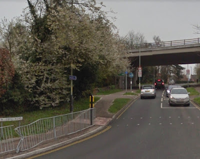 ... and its eponymous estate is off to the right a little further on from the underbridge..

The actual terminus road is Norvic Drive and, tada, lo and behold ...

... there is still a stop at the top of the hill today. fbb suspects that, back in 1970, buses would turn left in a little terminal loop.
90C - GREENWAYS ESTATE
The 90C travelled south down Church Road, left into Greenways ...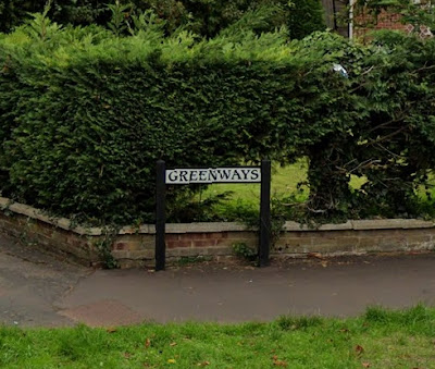 ... then along the road which provides the terminus' name. The homes along here, fbb guesses, would have been very new in 1970. Mt K shows the bus as terminating at a road called Brentwood ...
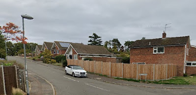


... presumably by reversing; and terminate it must; because a few yards further on, Greenways came to a blocked end. It still remains blocked to vehicles ... ... despite there being newer new housing on the far side of the bollards!

But there are still poles and flags on Greenways.

So with his investigative hat on, fbb now wants to know what buses replace the 1970's 90, 90B and 90C, assuming, quite reasonably, that nothing now runs down Colney Lane as was once served by 90A.
Such an investigation is not relevant to fbb's Mission (Im)possible, but will give some extra local colour to the eventual results.
But sorting out today's bus services is more of a struggle than it ought to be.
But it is all on-line!
This modern picture shows a Pink Line bus en route to (or from) Eaton - so maybe we have a clue ... ... and a 10A to Cringleford!
 This bit of investigation looks like being very easy!


Famous last words?
Next Cringleford blog : Friday 10th March
No comments:
Post a Comment