2012 Is The Best We Can Get
It turns out that the 2012 Bicester bus map from Oxfordshire County Council's web site is about as much use as a chocolate teapot.
Back then Stagecoach's S5 trundled down the main road between Oxford and Bicester, then (all numbered S5, obviously) whizzed of to various Bicester "suburbs" in turn.
Apart from one journey an hour to Glory Farm, the S5 now runs no further than the town centre.
Back then Glory Farm journeys continued to Launton or Langford whilt other journeys ran direct to Arncott.
In 2021 Stagecoach now runs a service 26 to Kingsmere which is just a blank space on the 2012 map.Note Middleton Stoney Road.Through this newer development runs the aforementioned 26, calling at the Community Centre and Co-op shop as it goes ...... joined by an occasional peak hour twiddle from the S5.But there is more subtlety to the Stagecoach operation in Bicester.
When it gets to Bicester Centre, the 26 changes, like Cinderella's pumpkin, into something else.It becomes either an H5 or a service 29. This scheduling cleverness provides a half hourly service via the embryonic Graven Hill, a former vast military depot ...... and home to one end of the Bicester Military Railway.The Bicester Military Railway was the primary mode of transport at the Central Ordnance Depot Bicester. Work on surveying the land for the rail system commenced in April 1941 and the 2.6 miles of railway that circled Graven Hill had been pegged out ready for construction by August 1942. Track laying was well underway by the following month. Initially the entire track was to be laid using concrete sleepers. Once it was realised that the light coloured concrete sleepers were highly visible at night, it was intended to replace them with conventional timber sleepers; however, limitations on the supply of timber dictated that some of the concrete sleepers were retained and these were painted with a thin coat of black bituminous paint to tone them down.
The Graven Hill railway loop is scheduled for a major housing development ...... but, for the time being, the 29 just peeps in to the edge of the new-build just beyond the roundabout on the A41.Alternate 29s venture further to Arncott (more Military Railway) or Bullingdon Prison ...... while the H5 strides onwards to John Radcliffe Hospital and Headington via Merton and Islip.
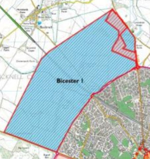
There remains but one mystery for those seeking to understand buses in Bicester. What has happened to the 22 and 23 from the 2012 map which served (for want of a better name) North Bicester?Now that IS a conundrum! If we look at the blank expanse to the north and west of the green lines ...... we dee nothingness on the 2012 map. But if we peep at Google Earth ...... we espy the beginnings of yet another development. From a bus point of view this is called Elmsbrook. It is the first phase of what is being called an Eco Town, an extra layer to the north and west of the present town boundary.The current Elmsbrook refers to the two bits in red on the above "structure plan".
Route E1 is operated (tendered, of course) by Grayline Coaches.The timetable as printed in simply not helpful, but readers can work it out for themselves! Perhaps. Or you could try Traveline's version.
Does it serve the former service 22 and 23 area of Nortrh Bicester? The closest named stop is Caversfield Old Vicarage ...... with nothing shown within the estates.
Unless fbb has missed something - but if he has (it has been known!) what he has missed is easily missable.
To conclude this Bicester magical mystery tour, tomorrow we will take a brief look at the stops in the town centre.
Will that be fun as well?
Meanwhile - Shock News (NOT)We have come across these little driverless pods (with drivers!) in various locations world wide.Apparently the Vienna authorities consider that the technology is not yet "advanced" enough to continue with the trials.Now there's a headlie for fbb:-And an answer?
Next Bicester blog : Tuesday 17th August


No comments:
Post a Comment