Thursday, 28 July 2022

London 1 - Paris 13 (Part 4)

We've Left The Left : Now It's Right - Right?

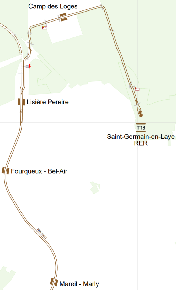
We are travelling north (ish) on the new T13 tram which runs from Saint-Cyr (near Versailles) to Saint-Germain-en-Laye. For most of its length it uses the track bed of the long closed (68 years closed) Grande Ceinture railway line built to encircle Paris.

We left our trajectory yesterday at Saint Nom, the terminus of Transilien line L

The next stop north, at L'Etang - Les Sables, never was a station on the Grande Ceinture or on the Tangentelle section of Transilien line L. It is just a new tram stop!
But we soon regain the former stations.
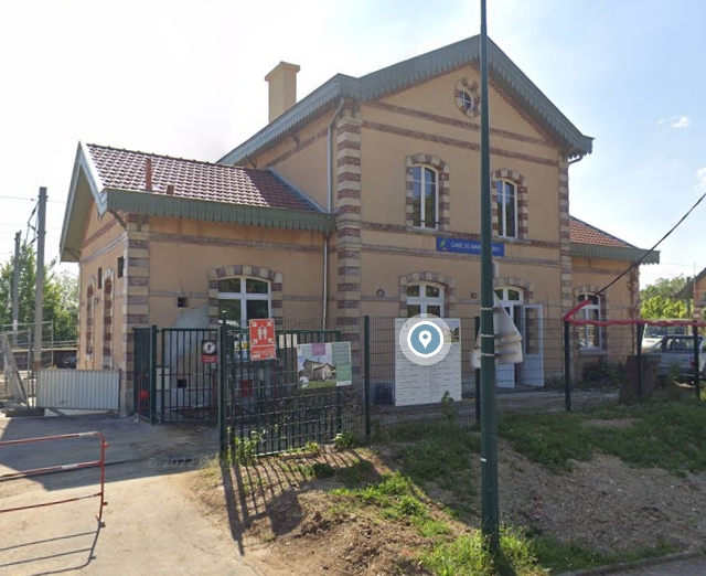
Mareil-Marly retains its station building ...
... which will no longer be used under tramification.
We are now moving into the urban sprawl of Saint-Germain-en-Laye which once boasted three stations bearing the town's name.

First was Saint-Germain-en-Laye-Bel-Air-Fourqueux, yet another short snappy name that is easy to remember when booking your ticket - NOT!
This is really shoe-horned in to the suburbs plonked up on the embankment ...
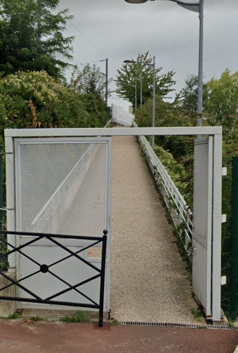
... leading to the rebuilt Viaduc St Leger that we met yesterday; but there is now a lift ...
... to ameliorate the long climb!
The station name has been changed to lose its Saint Germain tag.  It is now simply (?) Forqueux-Bel-Air.
The former Tangentielle terminus ...
... is renamed Lisiere Pereire! Confused.com yet again. 

But, again, the ancient building remains in good condition.
But as you leave here something truly remarkable happens. At the station, we are a train, running on the LEFT using SNCF rules and signalling whilst sucking power from 25Kv overhead - like all "proper" electric trains in France.
North of the station we become a tram running on the RIGHT and sucking a modest 750V from tram overhead. Signals are standard "white lights" drive on sight.
It really IS a tram-train - not like the feeble attempt at the genre that cost so much to install in Sheffield.

The corners now become tighter and speeds lower as we follow ordinary roads ...
The stop at Camp des Loges was still being built when Streetview visited ...
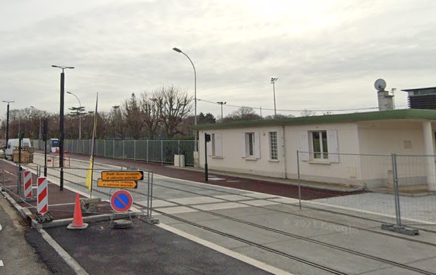
... but, of course, everything is on reserved track.

The trams then turn south along the Route Des Loges ...

... before terminating at Saint Germain. This long "Avenue" will take us all the way to the end of the line.
But, if you go down to those woods today, you are sure of a big (hmm, not so big?) surprise! Look at the "crease" that curves through the middle of the afforestation from bottom right to left centre. (Picture below. The different "colours" of the trees are not a fluke if nature, merely the consequence of stitching together different Google Earth images.)
Now point the other way, due north.
Many years ago, there was a train link from the rather remote Grande Ceinture station round into the centrally located terminus of what became RER line A. Here it is on an old map.
You would presume it closed when passenger services were withdrawn from the Grande Ceinture.

Tomorrow, we conclude this tramway tour-de-force with some screen shots of a video journey en route and a look at the connections available at the Saint German terminus.

 Next T13 blog : Friday 29th July 

Wednesday, 27 July 2022

London 1 - Paris 13 (Part 3)

 When Is A Tangent Not A Tangent

We all remember our Geometry lessons at school (don't we?) and are therefore well aware that a Tangent is a line which just touches a circle at right angles to the radius. With that piece of useful information firmly ensconced in the grey matter, we might be able to unravel the problem of real trains at the Noisy-le-Roi tram stop!
One of the many maps of Paris' tram T13 shows all its connections with other rail services and an extension which will undoubtedly appear in due course.
Next stop north from Noisy-le-Roi is the snappily named Saint-Nom-la-Breteche-Foret-de-Marly, only slightly abbreviated on the station name board!
There we meet Transilien Line L. Transilien is an SNCF "brand" for trains serving the Ile-de-France area, i.e. Greater Greater Paris.
Cleverly, Paris is marked with a P; surrounded by Greater Paris (very faintly shown as A, B and C); then come the much larger Ile de France districts. Our tram T13 runs from near Versailles to St Germain-en-Laye, relatively close to the Greater Paris boundary.

Line L, like all these suburban non-RER lines is a bit of a hotchpotch of branches, usually emanating from one of the the Paris terminus stations; in the case of L that is Gare Saint Lazare.

A diagrammatic plan of the rail lines shows one of the branches of L terminating at St Nom etc. (map below, upper left).
And here is a train arriving at St Nom.
The station building and tram stop are adjacent.
Transilien L would appear to be popular with park and ride commuters!
Another branch runs to Versailles (same map), a line which fbb has ridden AND blogged about (search for Variety in Visiting Versailles). The third L sets off in the opposite direction and joins RER line A to the north west of the city.

Diagrams are OK, but fbb likes to fit transport into the geography, so was delighted to come across a geographical map of Transilien and RER routes.

And look! There is the northern branch of the L (coloured lilac) ...
... and the two southern branches.
But look again at what happens at St Nom.
There is a shortish bit of line L called the Tangentielle

It would appear that "Tangentielle" is/was a brand name for services re-opening the Grande Ceinture line which ran all the way round Paris,

Tramway T11 (partially open but planned to expand) was originally branded as Tangentielle Nord ...
... and there are big plans for Tangentielle Est serving Aeroport Charles de Gaulle ...
...and Marne-la-Vallee Chessy (as in EuroDisney).
This line, if it happens (surely when it happens), will be mostly a re-operning of a local service on the Grande Ceinture. None of these lines are anything like a "Tangent" - surely "Orbitale" would be mathematically better?

Another label which crops up on-line, associated with the Tangentielle L and tram T13 is Grande Ceinture Ouest.

That little nomenclature discovery finally unlocks the truth of the railway that became tram T13.

La Grande Ceinture Ouest (GCO) était un service de voyageurs exploité sur la ligne de la grande ceinture de Paris de 2004 à 2019, en tant que partie intégrante de la ligne L du Transilien.

Intégralement située dans le département devs Yvelines, la GCO reliait la gare de Saint-Germain-en-Laye-Grande-Ceinture à la gare de Noisy-le-Roi. Elle est mise en service le 12 décembre 2004, marquant le retour du trafic de passagers sur la ligne après 68 années de fermeture.

Le succès de cette courte ligne, ne reliant aucun pôle d'importance, et isolée du reste du réseau, est toutefois mitigé, celle-ci connaissant un trafic anecdotique. La ligne est néanmoins utilisée comme une vitrine pour la SNCF, qui y teste diverses innovations dans les trains et dans les gares.

Dans le cadre du projet de ligne tangentielle ouest, il est décidé de transformer la ligne en tram-train et de la prolonger à ses deux extrémités. Elle laisse sa place à la ligne T13 Express du tramway d'Île-de-France, qui est mise en service le 6 juillet 2022.

Creating this line mainly as a test bed for future S N C F developments was far from cheap. Notable (and expensive!) work involved the rebuilding of a former lattice girder viaduct across the Val St Leger near the northern terminus of Saint-Germain-en-Laye Grande Ceinture.
Yep. A big job!
Here is the whole thing c/o Google Earth.
There is even a footpath all the way across, from south ...
... to north.
There doesn't appear to be a footpath over the original viaduct but fbb is not sure!

Tomorrow, we will complete our virtual survey of the tram route but meanwhile, a question.

Would British Rail, Railtrack, Notwork Rail, Great British Railways (or whatever it is called next) even consider reopening and electrifying the line between Northampton and Bedford, then, fifteen years later, converting it to tram train and extending north to Market Harborough and east to Sandy?

As folk are wont to say ...

VIVE LA DIFFERENCE!

How Much?
That deLuxe Bachmann class 47, in its weird Rail Operations Group livery, is not cheap.
Only £370!! BEYOND OUCH!

On-line Error!
It's not a SECAND - it's a SECANT.
Never believe anything you read on line without some validation! 

fbb had never heard of a  "secanD" but had heard of a "secanT" but had no idea what it was!

 Next T13 blog : Thursday 28th  July 

Tuesday, 26 July 2022

London 1 - Paris 13 (Part 2)

 Saint Cyr to Noisy Le Roi

Don'y worry if the above is a bit fuzzy - better maps will follow. But we are exploring the latest arrival Tram-wise in Greater Paris. This tram is a tram-train and, like Tram T4, is operated by SNCF as part of its "Transilien" network.

At Saint Cyr the trams will offer connection with one of the many branches of RER C (the YELLOW one). The station was once called Saint Cyr L'Ecole and the line was on an embankment, hence the need for many staircases.

The embankment is still there and rather ugly from the point of view of local properties ...
... and the station, although more efficient, lacks the character of the original.
But, of course, it does have a bus connection!

But humble Sainte Cyr had a second station called (surprisingly) Saint Cyr Grande Ceinture (GC).

The building survives ...
... but will not be used by T13. Before we see what replaces the old GC stop, let us see how trams get from the former rail route and into the present Saint Cyr station. This view from the main road East to Versailles ...
... shows a single track veering left on the route of the GC, which leads to the T13 depot; with the double track of the passenger tram service turning sharp right. It will then climb up to terminate level with the RER C tracks.

When Streetview was viewing the back streets of Saint Cyr, only the clearing of undergrowth had been done ...
A Google aerial view reveals a little more of the new-build route into the station.
The sharp curve is bottom right.

The replacement station for the old GC stop is a little further north ..
... reached by a new-build access road along which StreetView has yet to view the treet.
The new stop is called Les Portes de Saint Cyr, although whether the town ever had gates (portes) this far out is debatable. An artist's impression implies that buses will serve this tram stop!
Let's look at one of those detailed maps.
Next stop north is Allee Royale which fbb erroneously called L'Avenue in yesterday's blog.
You can spot the tram station lower left, There was no GC station here.  But there was a huge rail-served warehouse, still in use but without the sidings.

The view towards the Palais de Versailles is just about spottable as an open space between two lines of treet.
Note that the terminus is now called Saint-Cyr RER.

And on to the next section.
The station at Bailly ...
... was very small but a T13 stop is on the same site.
Next North is Noisy-le-Roi ...
... a community with a typically grand Hotel de Ville (Town Hall). Noisy le Roi and Bailly form the first significant community after leaving Saint Cyr.
But when fbb sought pictures of Noisy le Roi station he was surprised to find in open and in good order ...
... with full signage and, no less, trains in the platform.
But, hang on there! Did not fbb imply that T13 was a new service running, at best, on some old freight route called the Grande Ceinture? Where have the passenger trains come from and, more to the point, are they still there?

But there are recently refettled bus stops just outside the station ...
... in both directions. They are obviously smartened up for the arrival of the tram!
There is no mention of trains on Google Maps;
The answer to fbb's befuddlement would appear to be that the trains have been replaced by the new tram service.

So, obviously fbb has missed something.

But what? And when? And where?

Maybe the old man can sort it out for tomorrow's blog!

In the meantime here is a picture of a T13 tram on test.
Swish, eh?

 Next T13 blog : Wednesday 27th July