
Making The Marsh Magnificent?

Ancient maps of Bristol show a church, St Phillipe, in splendid isolation but close to Bristol Castle. The land to the east of the River Avon was low lying and prone to flooding - hence St Phillips Marsh. The building of the "Feeder Channel" to stabilise water height in Bristol's "Floating Harbour" made the area more stable and, as the city grew, roads, houses and business premises spread on to what was almost and Island.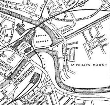 The above old map shows the station, the water courses and the cattle market. The GWR (the original and best, God's Wonderful Railway and not the upstart First operation) built an avoiding line through the Marsh area to take freight past the city, but avoiding the busy Temple Meads.

In the 1960s, most of the housing in The Marsh ...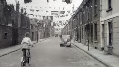

... was demolished with residents being moved to "better areas" to allow for more industrial development. In simple terms this has created the map of today.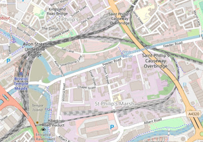 Missing from today's rail map is a line south following the A430 (map above, right) which led to places like Radstock and Midsomer Norton. There was also a complicated set of lines exiting the above map centre left and serving the harbour and docks area.
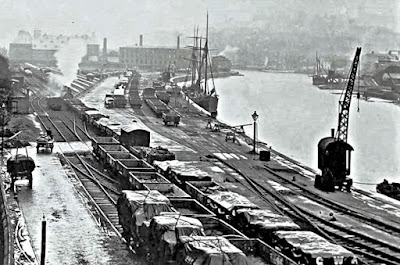 There was a lot of dock and a lot of railway serving it!


Back in the days of steam you would find THREE loco depots strung out round the loop, as it were.
Bath Road (Great Western) serviced mainly passenger locos and was adjacent to Temple Meads station. Here it is viewed from the southern end of the platforms. This is now a large part of the Temple (non)Island development area.
 At the north end of the station was Barrow Road.
 fbb thinks this was the LMS depot for locos from the line to Derby. Here Barrow Road can be seen on a preset day map.
 The depot still holds trains today.
 The biggie, depot wise, was St Phillips Marsh. The main buildings have long gone and fbb could find no pictures of its exterior; or even a simple track diagram. There were two turntable-equipped sheds.
 But there are plenty of illustrations of the atmospheric and nostalgic inside "parking".
 Those were the days!
 The steam shed has been demolished and the site taken over by Bristol's wholesale fruit market.
 But is hard to imagine there was ever a smoky, noisy, greasy engine shed there!


There is also a massive Sunday general market to enjoy. If you like that sort of thing!
 The big shed was located on the south of the by-pass line. Mainly to the north of the tracks, two sets of sidings were developed.
 The tracks to the east were a depot for HST sets, trains soon to disappear completely from out national rail network with the exception of preserved units.

Of course, to imagine this area as part of a trendy residential and light industrial area under the overall title of Temple Quarter is almost impossible. But as the famous report says, this is a long term project.


A wide collection of HSTs was on display at a 2016 open day.
The western set of tracks are used for more mundane diesel units.

Of course, to imagine this area as part of a trendy residential and light industrial area under the overall title of Temple Quarter is almost impossible.

Will it ever happen? Only time (and plenty of time) will tell.
This is what the report says.
 Maybe some future blogger, successor to the late fbb, will be writing his/her thoughts in twenty or thirty years?


Next Rural Bus blog : Friday 17th November
Another place where it's hard to imagine that "there was ever a smoky, noisy, greasy engine shed" is the site of the main Taff Vale Railway shed in Cardiff - now all part of Cardiff University (but with the railway line still running through the middle!)
ReplyDeleteTodays photo of the docks by the harbour is interesting. FBB refers to its exit on the lower left.
ReplyDeleteMy take is that the photo was taken with the Redcliff Tunnel behind the photographer. The line exited the tunnel (below lower right) crossing the main Bath Road and joining the main lines north of Temple Meads.
There was a single track that exited on the left that went under the Cumberland Road on a skew bridge - this was there when I last walked along there. Via a complicated set of points enabled freight wagons to access the bonded warehouses near Cumberland Basin and further goods yards on the north side of the harbour.
The photo shows two large buildings - do they still exist?