The Tube Map Which Isn't

It's called the "Tube" map because it used to be services operated by London Transport Underground trains - and nothing else. Over the years definitions have become blurred, so now the "Tube" map includes everything on rails that is "controlled by" Transport for London. So it includes the trams at Croydon ...
 ... the Elizabeth Line line ...
 ... and all of the "Overground".
 Both Elizabeth Line line and the Overground are actually British Rail lines (National Rail) but managed by Transport for London, So you can buy a "normal" national rail ticket to e.g. Bond Street.


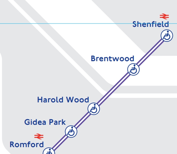


All the Overground lines are shown in ORANGE which is just plain daft.
Then there are the anomalies. Recently Thameslink has been added to the "Tube" map ... ... but it is NOT managed by TfL.

Heathrow Express (hyper rip-off charging innocent visitors a ludicrously high fare) does not appear at all ... ... but the nattily named IFS Cloud (line?) does - and it, too charges rip-off fares just to cross the Thames in a swaying bubble.


Nice.

But, from November, that standard "Tube Map Plus Other Stuff' has been upgraded to show the "full" (well, not quite) service on the Elizabeth Line line.
Other changes have been made at the same time. (click on the graphics for an enlargement)
We have already seen a tidying up at Paddington with the purple trains running through (well, half of them, anyway). Likewise at Liverpool Street.
 Here things are really complicated. Because the Elizabeth Line station is so huge, it stretches from Liverpool Street to Moorgate, so these two have become one "station"; a bit like the good old Bank and Monument with the "escalator connection". Remember?
 Another change for the present map shows ...
 ... the rejig now the Liz trains from Shenfield no longer run into Liverpool Street but junct with the service from Abbey Wood and use the "proper" Crossrail tunnels.


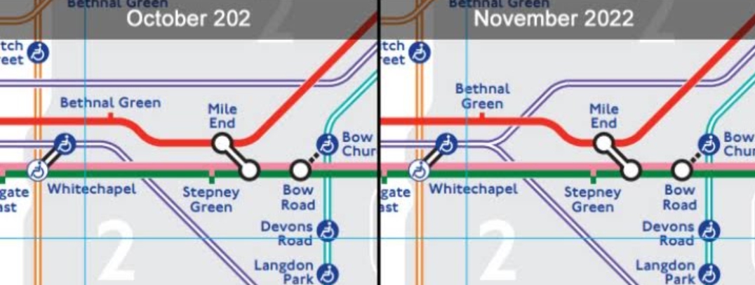
There is a fourth change which comes as a bit of a surprise because it is not provoked by the new service. On the October 202(2) map there is notable Nunhead at the bottom right. But from November 2022 it has moved dramatically to upper far left!

What's going on? And where is Nunhead anyway? There it is, lower left and well to the west of the Overground lines at New Cross Gate and New Cross. The October map showed it due south of Deptford - which it never was. So a good correction.

But, back to Paddington.
In due course, fbb will look in detail at two more recent private redesigns of the so-called "Tube" map.
This, from Mike Hall's Behance web site, is his take on Paddington. His whole map is still too crowded in the central area, but he is trying to compress the network into an A4 page. His Paddington does not address the comparative remoteness of the former Bishops Road (Metropolitan) station but it shows everything very tidily.

What is excellent is that he indicates the closeness of Bayswater and Queensway stations which are almost next door to one another ... ..., and that a short stroll is the easiest and quickest way to interchange with the Central Line at Lancaster Gate when arriving at Paddington.
 Neither are shown very well on the official map.
 You really wouldn't want the hassle of going via Notting Hill Gate and changing in either case!


The other map appears on-line as "a geographically accurate Tube map" ...
... which it isn't.
A better heading would be "more geographically accurate, but still not to scale" but that might sound a bit negative.

It is not quite so good for Bayswater Queensway and Paddington Lancaster Gate but still miles better (literally!) than TfLs attempts.
And that thin salmon PINK line is ...
... tada ...
... Heathrow Express; the first ever "Tube" map to show it. 

It is shown "conventionally" as running direct, even though it and the Elizabeth Line line use the same bits of rail.
Good on you. Mark!
 Yes, that is a much better way of putting it.

There are other "experimental" maps of the "Tube" which tackle Paddington. Just in passing, here are two.
First up is Max Roberts take, using concentric circles wherever possible.
It is certainly different; but is one of the best attempts at Paddington. It actually shows the Bakerloo Line doing what it does in reality.
 Another version, which has the non-circling Circle line tipped up so the sausage is sloping (and thus more correctly matches reality) has an even better stab at the Paddington complexity.
Whist looking, it may be worth reminding ourselves what "The Tube" actually does on the ground - OK, under the ground! On balance it is good that we have a diagram of any sort!


Neither appears to be published as a PDF, so legible enlargements are not possible. Sorry.


Thanks Harry Beck, you were a true visionary.

Snippet
Buying on line is so straightforward. Below is a response from EBay confirming an order and giving delivery dates.

Thanks a bunch, EBay!
Next Cartographic blog : Friday 5th January