
Potential Problems At Paddington?

Many of us know and love Paddington station, Brunel's London masterpiece ...

... and it is hard to grasp its intricacies and magnificence without going there and spending some time wandering about. Here is a street map.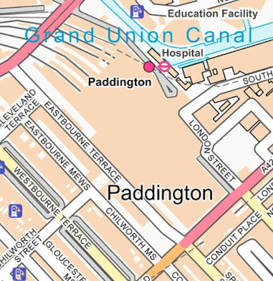 The two "RED" roads are Bishops Bridge (top left) and Praed Street (bottom right). On Praed Street, and opposite the hotel that fronts part of the station block, is a Metropolitan Railway station that was once called, not Paddington, but Praed Street.
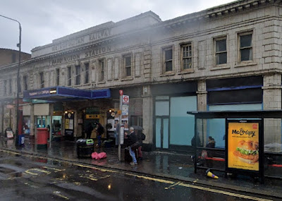
At the outer end of the main line platforms, and on Bishops Bridge, was another Metropolitain Railway station called, not Paddington, but Bishops Road. This was on the line to Hammersmith.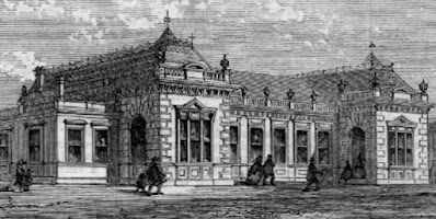 Its grandeur was eventually replaced by something much more humble ...
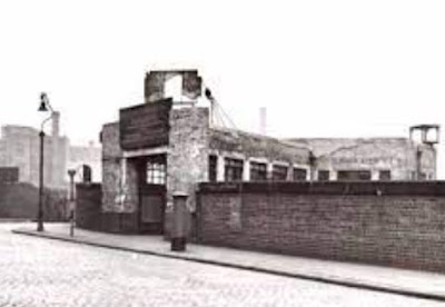 ... and, today, you will search in vain for a station entrance on the bridge.


Praed Street now carries trains on the non circling Circle Line (YELLOW) and the District Line (GREEN) both of which terminate at Edgware Road.


Because there isn't one. There is a lift and some steps down to the gentrified Canal Basin where the platforms now have a posh entrance. These platforms now carry Hammersmith and City trains (PINK) and a bit more of the non-circling Circle line (still YELLOW).

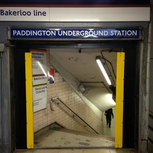
Next arrival at the Great Western terminus was the Bakerloo Line (BROWN). There used to be a very uninspiring entrance to the Bakerloo from just outside the main station seen here looking towards the hotel building on the left, This entrance is now closed and the area is to form part of a "Paddington Square" development ...
 ... with a much improved subsurface concourse for the Bakerloo platforms.
 The passages from the main station are also in need of improvement!
 A subway connects the former Praed Street station with the Bakerloo lines.
 Which leaves the Elizabeth Line line (PURPLE) station. Its upper parts sit enticingly on the road on the south western face of the main station ...
 ... called Eastbourne Terrace.


The subway link to the Bakerloo line was something of an afterthought ...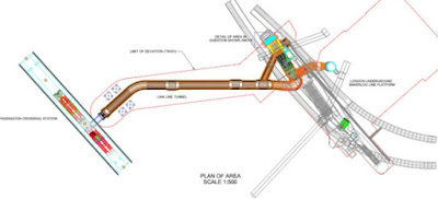 ... (Elizabeth Line line right, Bakerloo line left) because neither party wanted to foot the £40 million bill! But it did appear eventually.
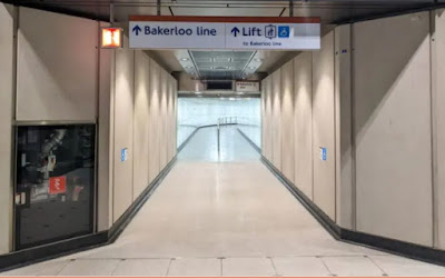 So what, you may ask!


We are leading up to a blog about the most recent changes to the "Underground" map and, whilst doing so, taking a look at some other other efforts to "do" the traditional map better.
Now we all know and love Harry Beck's London Underground diagram ... ... and we all know that all five of the stations discussed above, although in one sense very separate, are all now called simply Paddington.

So, how did Mr Beck and his successors cope with conveying the complexity of the four Paddington stations (no Elizabeth Line line in the 1930s!) to the typical troglodyte tube traveller.
The answer is that they tried but rarely succeeded.
Thankfully the ever ebullient Geoff Marshall has made a video about the fretful search of the five stations at Paddington. It is longer than the usual videos fbb posts, but it is well worth a careful perusal.
Enjoy!Geoff Marshall's video was made a few years back and we can now add map version 15 and 16 to his list
Map 15 - Elizabeth Line line disconnected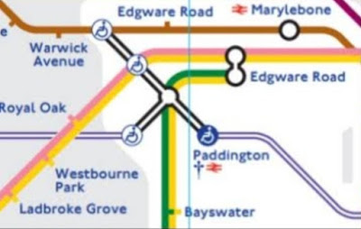 Elizabeth Line line trains were running from Reading to Paddington main line platforms and from Paddington Underground eastwards, but they were not joined up.

Map 16 - joined up thinking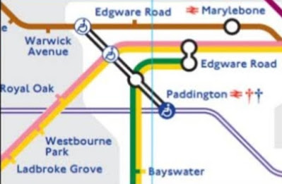
All over the celebrated Underground map there are problems to be solved as to how the cartographers can best communicate a complex network to a public that simply wants to find the right train for their destination.

All over the celebrated Underground map there are problems to be solved as to how the cartographers can best communicate a complex network to a public that simply wants to find the right train for their destination.
It ain't easy, buster!
Tomorrow, and before we look at two more (yes more!) interesting unofficial attempts at "improvement", we will take a closer look at some of the November 22 official map changes in more detail.
Exciting isn't it?
Exciting isn't it?
But this is weird!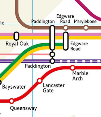 And this is weirderer!
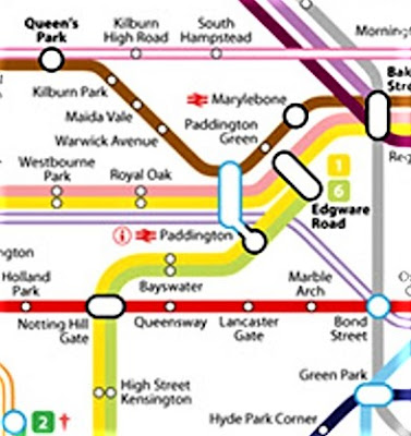
(Sorry it's fuzzy - don't fret, it's not your eyesight!)


Paddington Green????
Irrelevant Snippet


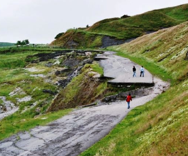
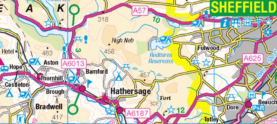
It was closed in 1979 after years of failed attempts to stabilise its foundations, built upon shale! Mam Tor was always known as the "Shivering Mountain" due to its unstable land. Presenter Rob was at pains to point out that Mam Tor was on the road between Castleton and Sheffield.
So it would be tricky for First's 272 to get through from Sheffield to Castleton, then? Mam Tor is to the west of Castleton and was on the A625 to Chapel en le Frith.
Erm, not quite, Rob!

Yet again, do not believe everything you hear and see on the telly!
Once upon a time, buses ran from Sheffield to Manchester via Castleton and Mam Tor ...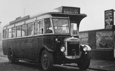 The continued to do so (Summer only) in the days of fbb's youth!

Next Cartographic blog : Thursday 5th January
No comments:
Post a Comment