Showing posts with label integrated transport. Show all posts

Wednesday, 18 October 2023

Is It A Tram OR Light Rail?

Helsinki Line 15 Opens On Saturday


The PR for the launch is impressive!

They call it a Carnival!

Half fare ...

... a day of frolic and fun ...

... with special information points at main stops.
That is what fbb calls a launch!

What is more remarkable is that this line does NOT serve the main areas of the city of Helsinki - it is an orbital route between busy suburbs.,

In the video that follows, your ride will start from Keilaniemi ...

(map, lower left) and orbit the city area remaining in Zone B ...
... until arriving at Itakescus (above map upper right).

From the above maps, you can see that there are connections with Helsinki's Metro at both ends of the "Light Rail" and at Otaniemi. There are also links with suburban rail at three stations en route.

These are at Leppavarra, Huopalahti and Viikin Tiesespuisto.

And what is Raide-Jokeri as in the heading of the above map? fbb cannot tell you because he is parlously ignorant of the Finnish lingo AND Google Translate doesn't translate; well, it offers "track joker".

Before enjoying about 5 min of spectacular speeded up video, we can look at the two termini. Streetview is far from up-to-date, so pictures are not easy to interpret. At Keilaniemi we just have an aerial view ...

... and a picture of the shiny new Metro station.
The video starts quite abruptly at the terminus stop.
At the other terminus we see, again, an aerial view, the tram/light rail stop and the metro.
The metro stop is underground ...
... well hidden beneath a block of flats and the co-op!
Of course there is a substantial bus station!
This is how public transport should be.

Here is the video, obviously recorder before opening and under test - hence the lack of passengers.
Well; is it a tram or a light rail route? Is it really a "new mode of travel"?

fbb reckons it's a tram ; but how different is it from "normal" Helsinki trams?  See tomorrow's blog.

Possibly the view of Helsinkihat is most well known.
Helsinki Cathedral is the Finnish Evangelical Lutheran cathedral of the Diocese of Helsinki. The church was originally built from 1830 to 1852 as a tribute to the Grand Duke of Finland, Tsar Nicholas I of Russia. It was also known as St Nicholas's Church until the independence of Finland in 1917. It is a major landmark of the city, and possibly the most famous structure in Finland as a whole when viewed globally.

But not served by Tram/Light Rail 15.

Snippet
It look a bit like, after months (years?) of speculation ...
... Deutsche Bahn is about to sell its Arriva business.
The reports are probably right as the Financial Times agrees ...
... but seems to think that Arriva only has buses in London.

The feeling from the financial gurus is that this may take some time as Arriva needs to be unknitted from Deutsche Bahn and this process may be "complicated".
Therefore yet another UK bus group is in the hands of an Investment Company - i.e. very much NOT in the hands of a transport group of any kind.

Customers and employees should be worried!

 Next Helsinki blog : Thursday 19th October 

Sunday, 19 June 2022

Riverside Review (2)

Over The Years

The RED road across the top of the map is the original A13; the railway is the "Tilbury Loop" The ORANGE road is River Road which originally just served the industry arrayed along Barking Creek on the River Roding. The River Roding is the same water course crossed by the Central Line at Roding Valley station.
At the end of River Road was Creekmouth Power Station hi.
A modern map shows some progress on the Barking Riverside development, but falls short of the true present situation.
It doesn't show the new railway, for example. So how about turning our view round to look south? This is what the riverside should look like when it is finished.

And What It Will Become!
Ringed in RED is the turning circle for the EL1 on Northgate Road; in ORANGE is the railway station and CYAN rings the landing stage as used by coal barges serving the power station. The YELLOW line is the so-called Goblin line (Gospel Oak to Barking Line) as extended.

We can put the same information on an aerial view of development up to (nearly) recently.
Turning back to point northwards, the same locations can be roughly plotted on the 1940s map shown at the head of this posting.
It is not accurate to the inch, but gives us a good idea. With this in mind let us go back to some pictures already posted on Roger French's recent blog. (thanks Rog!).

When The Boat Comes In
The current stop for the as yet unopened station is where the incomplete layby was shown in yesterdays's blog. The layby is now (almost) ready ...
...  but only adorned by a dolly stop.
We noted some blue hoardings yesterday on Streetview ...
... and there is now a temporary walkway ...
... leading (eventually!) to a boardwalk along the old coal delivery pier.
You then come to a substantial companionway leading to a new floating pontoon moored just off the "coal pier".
And finally, after a lengthy trek, you arrive at the Uber Boat which will take you back westbound to central London.
It is a nice ride, but will it attract genuine commuters? When Roger tried it out it was at a weekend and well loaded with passengers making exploratory journeys.

The Monday to Friday timetable offers extended peak time journeys only ...
... nothing in the middle of the day to the Barking Riverside pier.
But at weekends Barking gets a boat every 30 minutes at least, throughout the day.
The journey will  take about 1 hour and 15 minutes to Westminster, so the commute is not quick. How long would it take by Overground to Barking and then District Line to Westminster?

Less, of course, but a far less pleasant ride!

Through trains from Riverside do not run to central London - there is always at least one change and sometimes two.

The TfL journey planner gives a series of stressful and complicated journeys from Barking Station ...
... to which must be added, at least 10 minutes (including connection time) train ride from Riverside.

So a stressed cramped 50 minutes OR MORE versus a comfortable sail for one and a quarter hours.

Unfortunately the boat is twice the price!

It will be interesting to see what happens when the railway opens. The implication of TfL's train launch publicity is that the EL3 will be extended further ...
... we will have to wait and see. Services to the development may well depend on how TfL's finances are sorted out - if they ever are!

 Next Variety blog : Mondau 20th June 

Wednesday, 28 July 2021

Peeved In Peterborough (1) ...

How To Encourage Bus Travel!

On the left is Peterborough railway station and scanning to the right (to the east) are four buildings with blue painted roofs. These are four multi-storey car parks built to serve the Queensgate shopping centre which is on the far right.

The four car parks were given the names of local worthies, namely ...

Edith Cavell - nurse, cruelly executed as a spy during WW1
Frank Perkins - of diesel engine fame
Henry Royce - chum of Mr Rolls
John Clare - nineteenth century poet

Peterborough City Council then decided to be more "efficient" and used colours to smarten up the whole car parking experience.
This was met with a certain amount of opposition by the locals, so the Council compromised and used surname and colour together ...
The one you can't read is Clare Green, a delightful girl if ever there was one!

You might wish to find your way from railway station to bus station, only a short walk away says Wikipedia; so it must be right. If you were very, very fortunate, you might find an "onward travel" poster somewhere on the concourse.
These are not often obvious, if displayed at all - but it is all on line! It gives a simple map of your route from train to bus.
So let's do it!

We leave the station, turning right in front of the three star Great Northern Hotel ...
... probably the only bit of "old" Peterborough to remain in the station area.
Instead of toddling into the short-stay car park, we must turn sharp left but still on Station road, following the green line and its walking man from the map that we probably don't have.

Here, to offer a little encouragement for our exciting exploration, we find a white on blue sign which directs us to Queensgate Shopping Centre AND the bus station.
Incidentally, the building beyond the white-on-black sign to City Centre & Cathedral is NOT the cathedral but a building of equally amazing architectural delight, namely the Perkins Yellow car park!

The Cathedral is much further east and rather well hidden ...
... in fact very well hidden, a bit like the bus station ...
... but prettier!

So, according to Wikipedia, your route takes you across the Paten Bridge, named after a worthy city resident and owner of a wine merchant's.
If you were expecting something special you will be profoundly disappointed. If you were expecting signs to confirm that this really was the way to the bus station, you will be disappointed even more profoundly. The blue-on-white was the last, the only, sign until you are almost there.
But, ascend the ramps, cross the bridge and descend the ramps ...
...  and lo, you will find an entrance to Queensgate shopping centre.
And in the top left hand corner are the desired words "Bus Station". fbb would expect similar signs within the inescapable joys of the "mall" ...
... but he does wonder how you get there when the shopping paradise is closed. Presumably it is down a bit more rampage, possibly through a creepy car park ...
... and then round the outside of the Cavell Blue? There are, of course, no direction signs!

Assuming you find your way past all the lovely shops desirous of ridding you of your money, you would be directed to descend an escalator within the greenhouse.
You would find yourself on an island platform, to use railway parlance, with buses on both sides. Each side is a mixture of "parallel parking" ...
... and "head in" bays.
The above pictures are of the eastern side of the bus station, there is similar on the west. 

But, if we look at a recent Google Earth snapshot ...
... we see mayhem in the east!

Where buses once arrived, unloaded, loaded and departed ...
... and similarly on the far side of the access bridge ...
... buses there are none!

Indeed the view from the north down the eastern bays is decidedly blocked off!
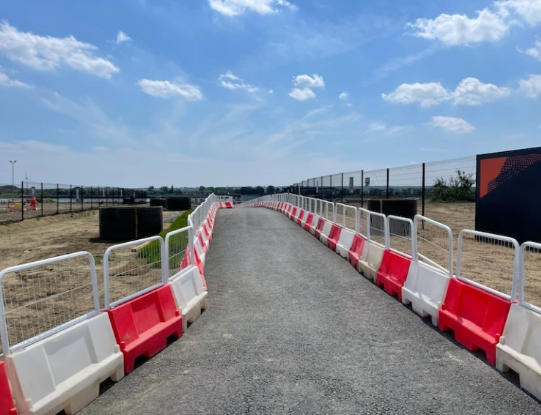
What is going on? Where have all the buses gone? Will they ever return?

Correspondent Alan (the Northampton one!) passed through on Sunday last and can enlighten us.

And will do so in tomorrow's blog.

Thinking About LEDs
fbb lies awake at night thinking of nothing else.

Here is the old man's reading lamp.
It consists of a cluster of bright white LEDs.
Although each point of light appears fantasically bright, the total volume of lumens is barely enough to help fbb read his copy of Railway Modeller.

Translate this to the Peterville signal box and lights in the ceiling give a reasonable shine ...
... brighter than the traditional signaller's oil lamp suspended above his ledger desk, but OK. But the exposed pseudo "bulkhead" light at the top of ther stairs is just too much.
The above was snapped in fading afternoon daylight, so when Peterville's skies are darkened well beyond twilight it will overpower internal realism (?) camera and human peepers. 

Maybe a bodge in the form of a square of translucent white plastic will do the job.
fbb will have to wait until it gets dark! But it is better than it was.

 Next Peterborough blog : Thursady 29th July