
A Bridge Too Far!! (Part 1)
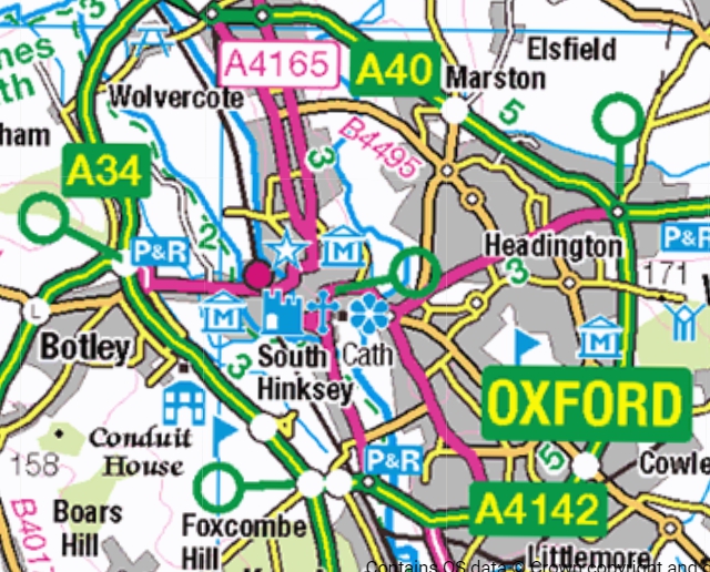
Botley Road runs due west between Oxford and, erm, Botley. It intersects with the A34 and contunues to Faringdon and Swindon. Therefore it is a major route to and from Oxford for motorists and public transport. The road passes the railway and its station which necessitates a bridge under the line.
So here is the Botley Road Bridge with majot work in progress to improve the tracks.

The above view, looking east towards the centre of Oxford, was snapped in 1979!
And in 2024, Notwork Rail is at it again - with a vengeance. As well as improving the track, the grand plan is to build a western entrance to the station.
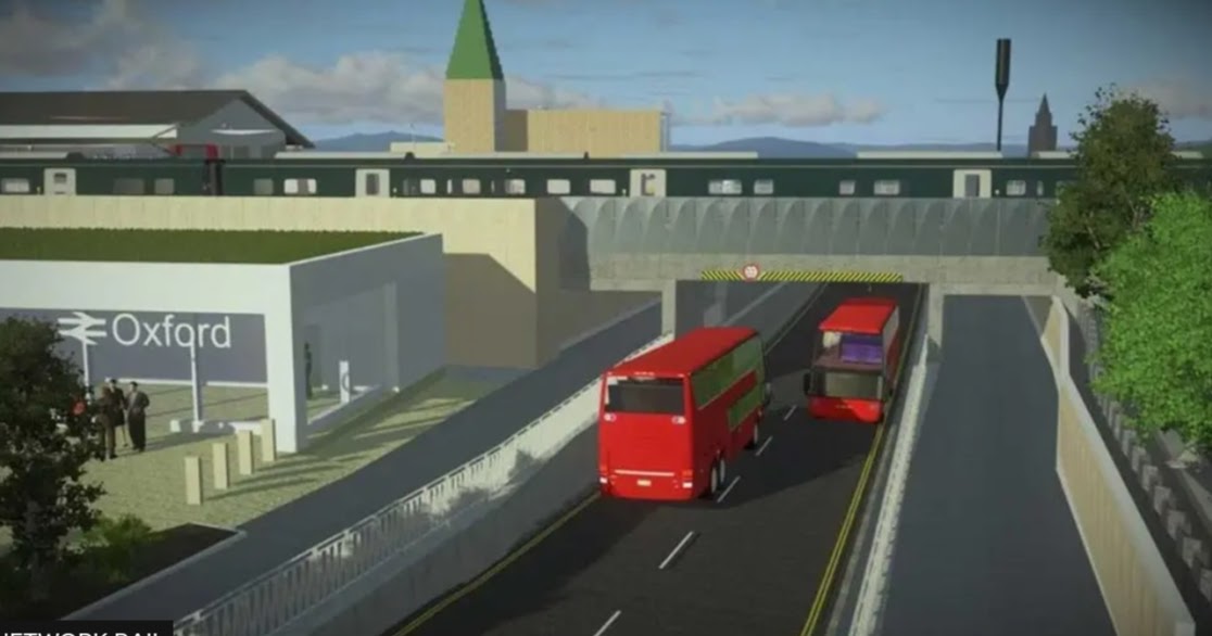
Note the spire in the background of the above artist's impression. It is not part of a golden sandstone Oxford University building of old, but the very modern (for Oxford!) spire of the Thatcher Business Education Centre.
.jpg)
Despite its aggressive modernity, it is part of the University.
Here is a better picture of the proposed new station entrance. Before we look at the bridge, it is worth seeing what was there before the new bit of the station was to be implemented. Amazingly ...
 ... it was a relatively modern YHA hostel!


And was is the right word. Here is a pre-demolition side view with the railway visible beyond.
 The steelwork is a signal gantry.


While the bridge work is in progress, the former YHA site is, ignominiously, being used as a bus park! There's that spire again!

So, let's take a look at these features using today's Streetview.
Obviously this was before major work started on the bridge. This more detailed extract from Open Street Map will guide us. We will start our journey at the three bus stop icons on Botley Road, upper left on the above map.

By the word "Road" near the bus stops is a bridge across part of the complex waterways in this area; a bridge which gives access to Osney Island. Here is a small enclave of property that is exclusive, expensive and comes with the added bonus of flooding.
At that bridge is a pub, The Holly Bush ... ... where fbb and No 1 son enjoyed an early and a "light" lunch.

Strolling on to the station they would have crossed the River Thames ... ... and passed the now demolished YHA ...
 ... before reaching the now-closed bridge.
 Note a narrow and scary footpath on the left and, just visible in its gloom at the end of the flower beds, a scary tunnel for pedestrians on the right.


Once under the bridge we enjoy a view of the footbridge linking the station to its car park.
Then a left had turn ...

With the notable exception of the pub on Osney Island, almost all of this Streetview progress will be impeded by the bridge rebuild complications.
As a further preview, here is the Google Earth view from pub (below, lower left) ... ... to station, upper right. The YHA has gone, the bus park is in use and the bridge has been closed, initially with lines of cones. (click on the picture for an enlargement).

But we can do better than that!
And that will be revealed in the blog post on Friday .
Next Torquay mini blog : Thursday 24th Oct
No comments:
Post a Comment