

We have been using the Notwork West Midlands map of Birmingham City Centre to find a bus to Boldmere, near Sutton Codfield. The dark blue colour shown us to make for the Bull Street Priory Queensway interchange ...

... which consists of a network of stops strung out along three sides of a wobbly rectangle on the north east fringe of the city centre. Other roads in the same "rectangle" are, confusingly, part of the Moor Street interchange.
For background see "From a Chum in Brum [1]" (read again) and "From a Chum in Brum [2]" (read again).
The leaflet has two indexes (indices?). On the front, beside the "dark blue line" map we find Boldmere. Goody!
 Not goody. That tells me where Boldmere is on the map. Maybe useful if ignorance is all-pervading; but most passengers will, at least, know that Boldmere is near Sutton Coldfield. Well fbb does, anyway!
 So, over the page to the city centre map - which also has an index. Wherein lies the mega snag with this mega map. The "centre" index is in route number order. And route numbers are not shown on the line map, remember. The name against the route number ...
 ... is the ultimate destination (the outer terminus) of that service. Boldmere is not an outer terminus.
The story so far:
We can find Boldmere on the line diagram
Boldmere is served by a dark blue route
We need to know the route number for Boldmere
There are no route numbers on the map
There are 17 dark blue stops
And we have not the slightest idea which one we want


The leaflet has two indexes (indices?). On the front, beside the "dark blue line" map we find Boldmere. Goody!

The story so far:
We can find Boldmere on the line diagram
Boldmere is served by a dark blue route
We need to know the route number for Boldmere
There are no route numbers on the map
There are 17 dark blue stops
And we have not the slightest idea which one we want
This map leaflet is
UTTERLY USELESS
To make it just a tiny little bit less useless we could add route numbers to the line diagram.
fbb will, after painful and lengthy research, reveal the route number of buses to Boldmere.
66A. Ta da!
Back to the useless map for 66A.
Oh dearie me; there isn't one.
Which, being interpreted, means that there is no bus service from Birmingham City Centre to Boldmere. You would need to change at Sutton Coldfield ...

... or Erdington.

Or ignore buses completely and take a train to Wylde Green.

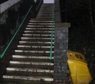
Walk up the steps ...
... but beware, the steps do bite.
You are then on Highbridge Road and within spitting distance of Boldmere.
Whatever you do, don't try to grapple with the Notwork West Midlands Birmingham centre map. It does, indeed, not work.
But fbb has a suggestion. Gather a team from them ...
 ... and from them (designers, to use the rerm loosely, of the map).
 Perhaps add in a group from the main bus operator ...
 ... who seem blissfully unaware that their customers are provided with such garbage!
Provide the contestants with their own map and nothing else; together with a target cross-city journey. Then see how many succeed. Or will they, like last week's comment writer ...
 ... simply give up.
But fbb has a suggestion. Gather a team from them ...
Provide the contestants with their own map and nothing else; together with a target cross-city journey. Then see how many succeed. Or will they, like last week's comment writer ...
Prochain blog français : Mardi le 25 août
Or a 907 bus, which appears on the Boldmere map extract and in the blue city centre indices?
ReplyDeleteAs a Brummie bus enthusiast, I know that the 907 does indeed run from the city centre to Boldmere (Jockey Road is at the north end of Boldmere). I am also thankful that I do not need to use the leaflet. The map is not fit for purpose - Network West Midlands should revert to the format they used a few years ago, and still use for Coventry city centre.
ReplyDeleteLike fbb, I wonder why National Express West Midlands does not produce its own Birmingham map. It could use one to highlight its many high-frequency corridors.