
East Side, Eyes Wide, I've Tried!

The above map is, ostensibly, the route of the tram extension to Arden Cross and/or Birmingham Interchange. As Heidi (currently Transport Minister) has just announced a further delay to HS2 for unspecified reasons and with an unspecified new finish date, who really knows?
So anything to do with HS2 must be though of as provisional.
The tram's "East Side" extension has been a real challenge for the old bloke, happily isolated from big city life in sunny Seaton. So apologies to Birmingham experts, but the old codger is trying to do his best remotely.
On recent tram maps the East Side extension is an insignificant pink wiggle near the city centre ....jpg) ... and there are lots of more detailed maps on-line including several showing various options for this bit of tram. Here is one ...
... and there are lots of more detailed maps on-line including several showing various options for this bit of tram. Here is one ...
... and here is another, slightly different, of course.
.jpg)


And here is fbb's interpretation, probably equally wrong. It is worth noting that the swathes of scorched earth coloured brown on the above Google Earth view (with fbb additions) is the footprint of Birmingham Curzon Street station, the terminus of the remaining very expensive shuttle service from London Euston - or it still might be from Old Oak Common!

This diddy tram extension kicks off at the junction of Bull Street and Corporation Street where we see the existing tracks taking a right hander to get to the main city centre tram station..jpg) The tram people have given us an impression of a tram descending Bull Street ...
The tram people have given us an impression of a tram descending Bull Street ... ... and Streetview confirms this location.
 From here to the HS2 terminus things are a little baffling as Centro have not given any captions to their pictures and the maps lack enough detail to be certain. But it looks as if the tram will blast its way diagonally through some existing buildings to be demolished. (They might have been bashed already; fbb is working from out-of-date on-line stuff).
.jpg)


Here are some more impressions which may (or may not) show the eventual route. But somehow, we get across Moor Street Queensway ...
 ... and aim for Millennium Point keeping all the above buildings on the left of the tracks.


At Millennium Point ... ... (which might not yet exist) we turn sharp right and travel via the underparts of Curzon Street station which definitely does not yet exist.
 All very impressive.


There is no point in trying to plot the route through the unbuilt station as there is nothing of any significance there at the moment. Some maps show Millennium Point as a temporary tram terminus - presumably until Heidi has built the new stuff!
Here is the best map again. So, for reasons that will materialise soon, fbb will now start at the Digbeth terminus where we find Birmingham's coach station (for real) ...
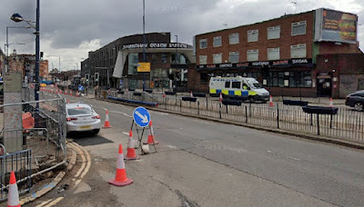 ... and by impressionist computer trickery with tram.
.jpg) Travelling towards Curzon Street, this right hand turn leads to Meriden Street and an area of low grade and declining industry with two splendid railway bridges. The first ...
Travelling towards Curzon Street, this right hand turn leads to Meriden Street and an area of low grade and declining industry with two splendid railway bridges. The first ... ... will take the tram tracks under the former Great Western line from Moor Street and Snow Hill.


.jpg)

Next bridge ... ... is the main line from New Street to Coventry and Euston.

Beyond this second bridge we become New Canal Street with lots of HS2 terminus hoardings where, one day, the East Side tram extension will run, linking up with the new station and Millennium Point..jpg) Currently (that's Streetview current!) we can drive a little further along New Canal Street to enjoy the former Curzon Street terminus of the London and Birmingham Railway - where it all started way back!
Currently (that's Streetview current!) we can drive a little further along New Canal Street to enjoy the former Curzon Street terminus of the London and Birmingham Railway - where it all started way back! This splendid and historic pile will find itself on the north side of the new terminus about half way along, dwarfed and eclipsed by its giant successor.
 .jpg) Maybe!
Maybe!
.jpg)

.jpg)
The building is not (and never was) on Curzon Street but, as we have seen, on New Canal Street.
If typical blog readers have understood all the above, they deserve some lavish award - but, sadly none such is available c/o fbb.
Their reward, however, is to move toward a fuller understanding of tomorrow's blog.
Or maybe not?
Next 'tram to Arden Cross' blog : Fri 20 June
No comments:
Post a Comment